
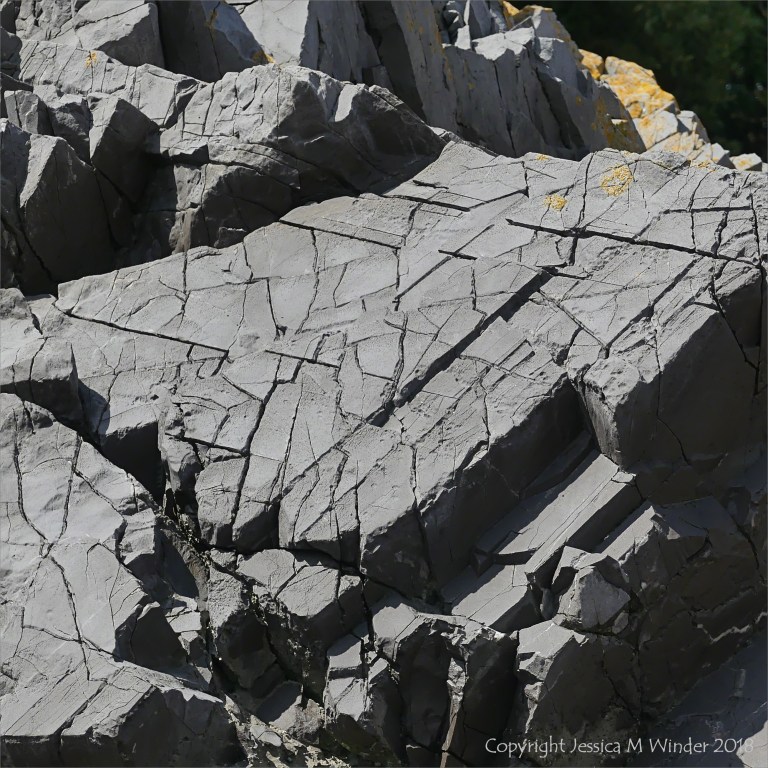
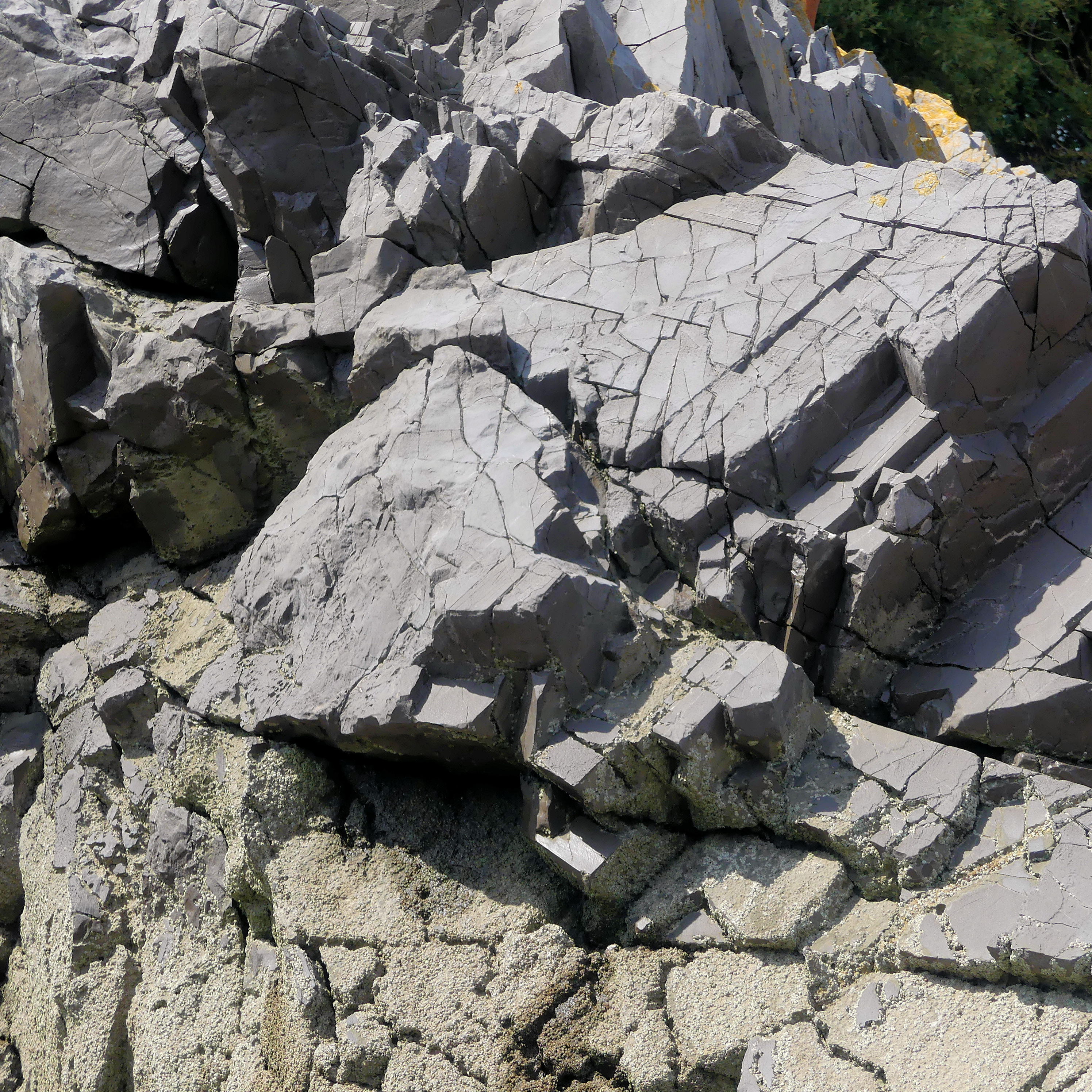
On the rocks at Caswell Bay 1 – Carboniferous Limestone rock patterns at Caswell Bay on the Gower Peninsula, South Wales.
This picture was taken on the west side of the bay at about GR 590876 on the solid geology map sheet 247. I think it might show High Tor Limestone but it is a place where the HTL lies close to Caswell Bay Mudstone, Caswell Bay Oolite. and Penmaen Burrows Limestone (now renamed Gully Oolite since the map was made, I think), and there is faulting. So it is a complex situation for an amateur to understand.
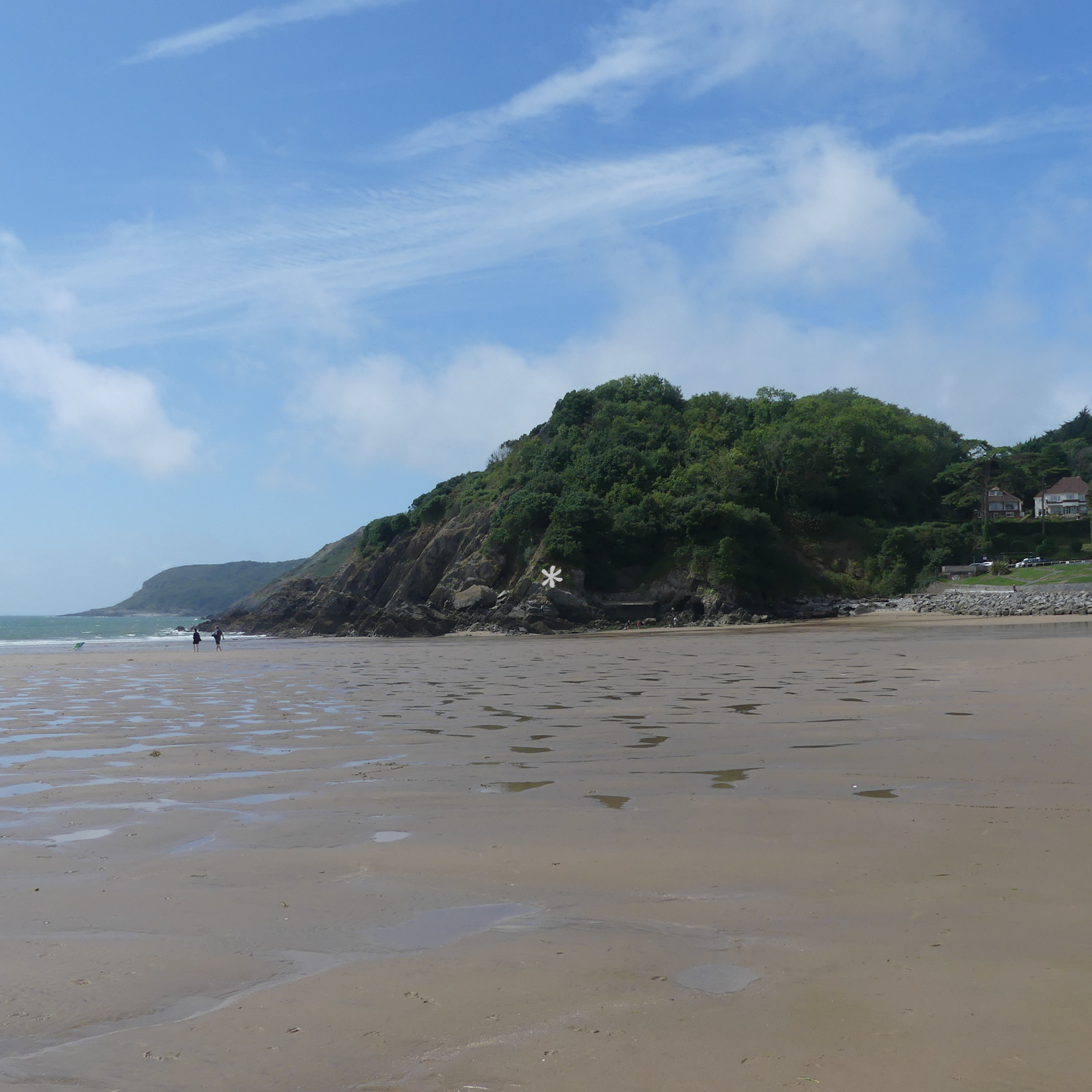
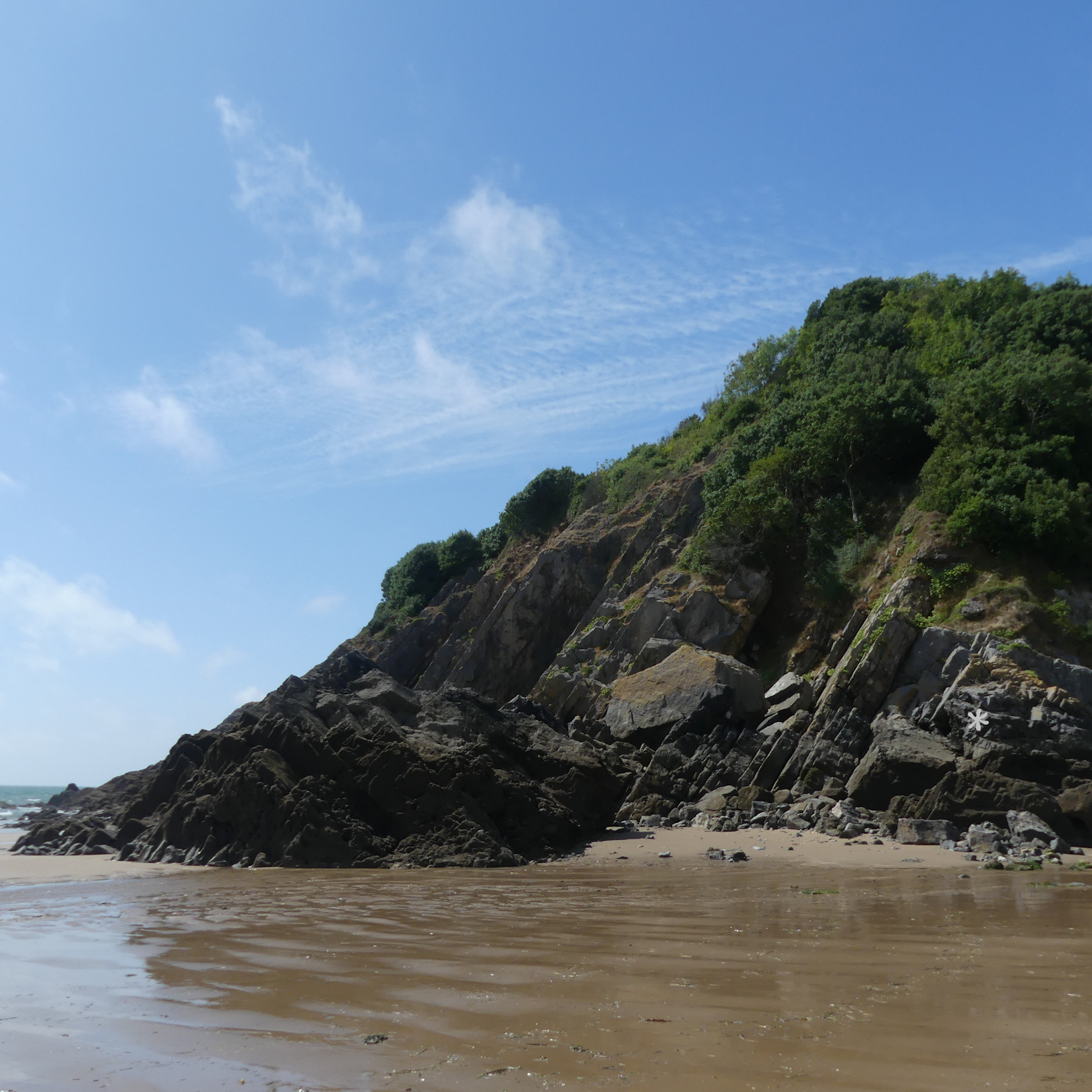
For anyone wanting to check it out, the location is shown in the four photos below. You can click on the pictures to enlarge them. In the first two images I have placed a white asterisk to mark the spot. It would be great to find out what the rock really is and what has given rise to the pattern of fractures. Maybe some acid dissolution has taken place to widen the cracks – the beginning of karstification. Other examples of this process can be seen elsewhere in rocks around the bay; some of the karstification is ancient – called palaeokarst – and is on a much larger scale with massive potholes and it clearly visible on the other side of the bay.


These are amazing patterns.
LikeLiked by 1 person
Thank you, Emma.
LikeLike
march 2 , 2024, just seeing this… I never tire of the patterns in nature.. Rocks are our ancient family holding so much life and drama. I’m just someone who loves patterns and colors, not a scientist… stones hold so much memory just sitting by them, holding a small stone in your hand, touching them is magic. thank you
sandra in Bermuda
s
LikeLiked by 1 person
Thank you so much for your lovely comments, Sandra.
LikeLike